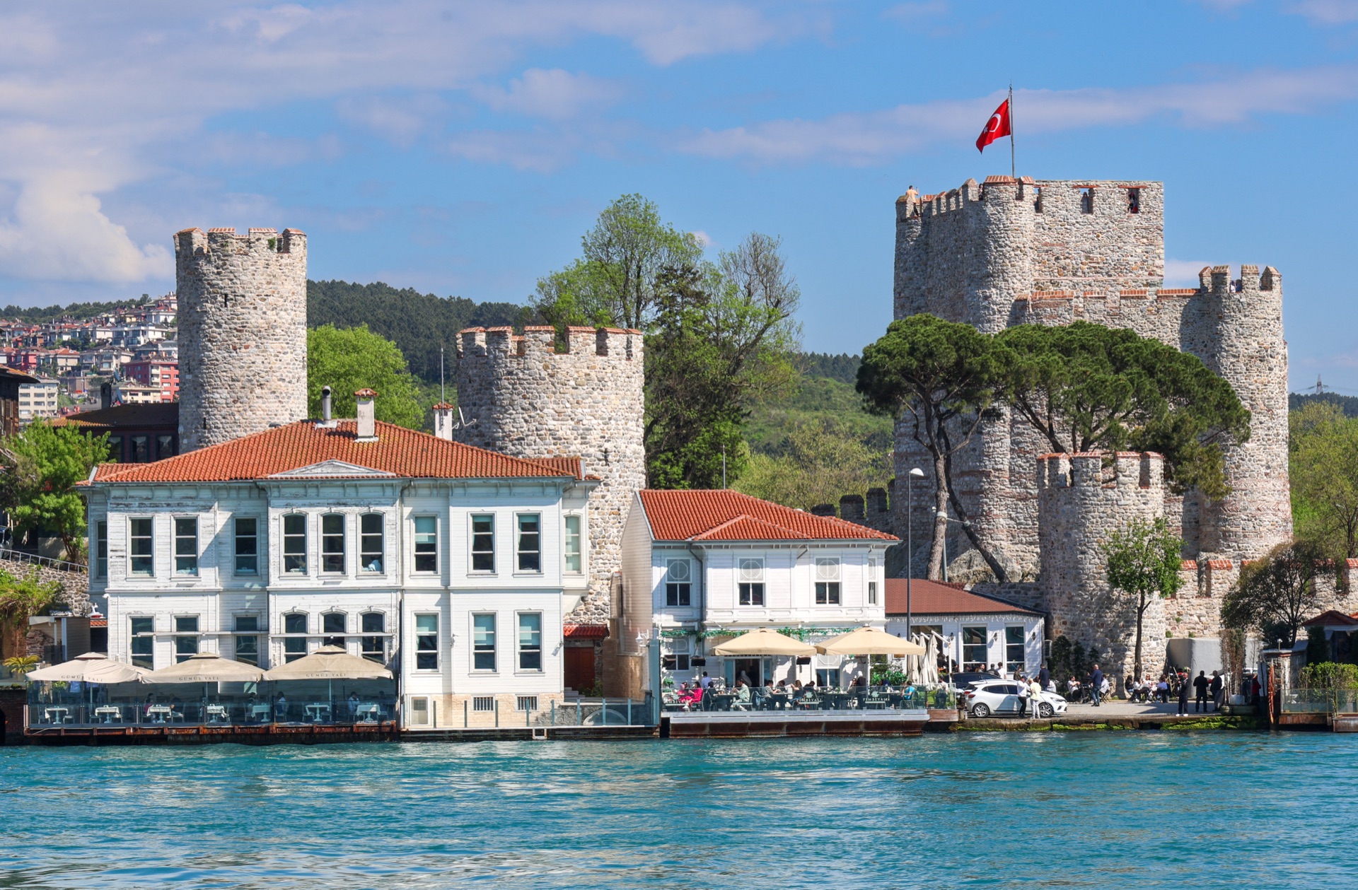
Anadolu Kavağı lies far in the north of the Asian Bosphorus shore and feels distinctly different from Kadıköy or Üsküdar. Many visitors reach the town on a long Bosphorus cruise and feel as if they've arrived almost at the edge of the city. Fish restaurants, small streets, and the view toward the Black Sea define the atmosphere. Above the town lie the ruins of Yoros Kalesi, a fortress often mistakenly called simply "Genoese."
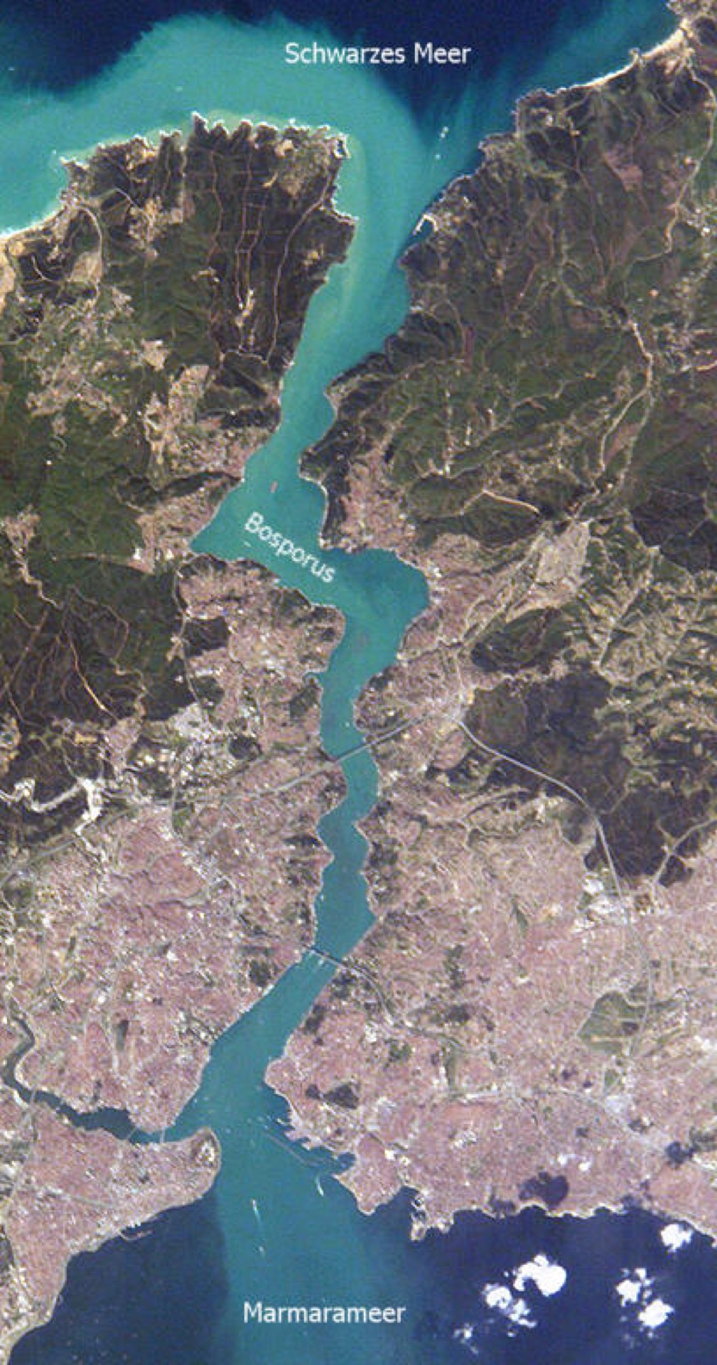
Anadolu Kavağı lies far in the north of the Asian Bosphorus shore. Above the town lie the ruins of Yoros Kalesi, a fortress often mistakenly called simply "Genoese" — in fact, it has Byzantine origins.
The history is more complicated. The fortress has Byzantine origins and, together with structures on the European side, controlled the northern access to the Bosphorus. It later changed hands several times, including periods under Genoese and Ottoman control. That's exactly why Anadolu Kavağı is a good place to understand that the Bosphorus wasn't just a beautiful view, but a strategic strait.
- Anadolu Kavağı lies near the northern exit of the Bosphorus into the Black Sea.
- Yoros Kalesi stands above it.
- The fortress is of Byzantine origin, though it's often loosely called a "Genoese castle."
- In the 14th century, Genoese controlled the complex for a time.
- It was later used and expanded by the Ottomans.
- The location served to control shipping traffic at the Bosphorus entrance.
- Many classic long Bosphorus cruises make their northern turning point, or a longer stop, at Anadolu Kavağı.
Why the northern Bosphorus was strategic
Anyone traveling from the Black Sea to Constantinople had to pass through the Bosphorus. Grain, wood, wax, furs, and other goods from the Black Sea region reached the capital by this route. At the same time, enemy fleets could use the same route.
Control of the northern Bosphorus entrance was therefore economically and militarily important. Fortresses, observation points, and customs stations monitored the passage. Yoros sat excellently for this, on an elevated point above the Asian coast.
Yoros Kalesi and its Byzantine origins
The Beykoz municipality explicitly notes that Yoros is often taken for a Genoese foundation, but that Greek inscriptions in its towers document Byzantine building phases. The fortress belonged to a system that controlled the northern access to the strait.
Byzantine fortification didn't mean every stone visible today comes from exactly the same building phase. Fortresses were repaired, reinforced, and adapted to new military technology over the centuries. Yoros is thus, like many Istanbul monuments, a building with several layers.
Where the name Yoros comes from
One common theory derives "Yoros" from Hieron, an ancient term for a sacred place. Another connects the name to the Greek "oros," for mountain. The Beykoz municipality names both possibilities and notes that the mountain interpretation can well be plausible.
Exactly such questions of naming show how careful one must be with seemingly perfect explanations. A name can change phonetically over centuries, and several languages can influence one another.
Turkish and Genoese rule
At the start of the 14th century, the fortress temporarily fell into Turkish hands, but was lost again. From the middle of the century, Genoese controlled important parts of the Black Sea trade route and also used Yoros.
This phase explains the popular name "Genoese castle." But use isn't the same as original construction. The Genoese took over and reinforced an older complex.
Mehmed II and the Bosphorus
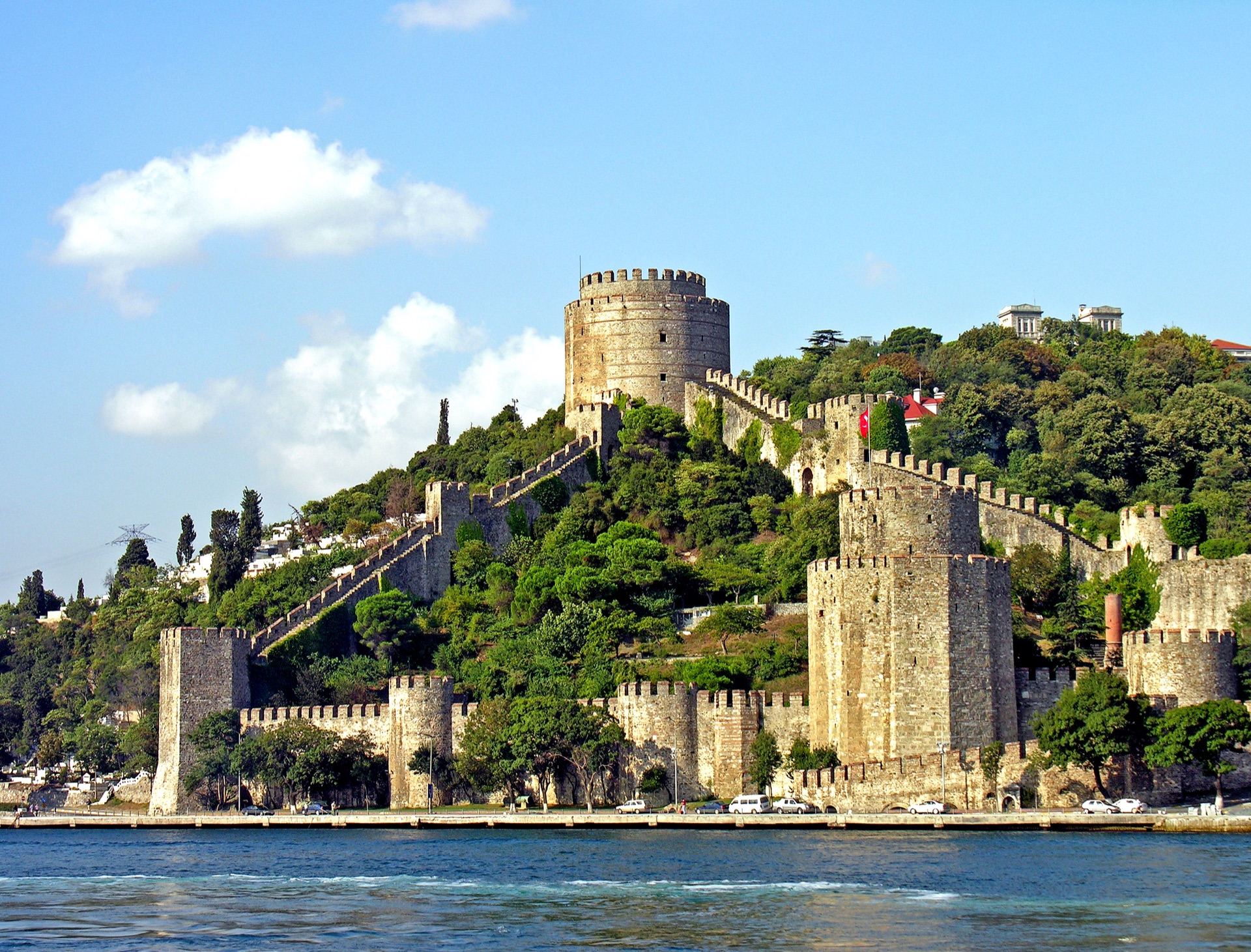
After the Ottoman conquest of Constantinople, control of the Bosphorus became even more systematic. Mehmed II knew the strategic significance of the strait very well. Even before 1453, he had a massive fortress built further south at Rumeli Hisarı.
Yoros and other northern positions remained important, because the Black Sea trade still had to be controlled. Later, the Black Sea developed for a time into a strongly Ottoman-dominated economic space.
The fishing village beneath the fortress
Anadolu Kavağı developed as a small coastal town with fishing, shipping, and supply. Its location at the end of long Bosphorus cruises eventually made restaurants an important part of local tourism.
Today this can look almost like a cliché: the ferry arrives, people get off, eat fish, walk toward the fortress, and travel back again. Even so, this touristic pattern follows an older logic. Ships have always needed supply and rest here.
Why Bosphorus cruises turn back here
The classic long Bosphorus cruises from the city center run far to the north and often make a longer stop at Anadolu Kavağı. From there, the Black Sea isn't far anymore.
That some cruises don't simply continue on is tied to route planning, schedules, and the transition into a more strongly militarily and navigationally controlled space. The claim "from here on it's all a military exclusion zone," though, would be too sweeping. The Bosphorus remains an international shipping route.
Military zones and the Black Sea
In the northern Bosphorus there are militarily used areas and strategic infrastructure. At the same time, the region has changed considerably due to the third Bosphorus bridge and new roads.
Anyone comparing older photos with today's landscape sees a region that's long since more than just fishing villages and forest. Modern megacity and historic strait meet here especially clearly.
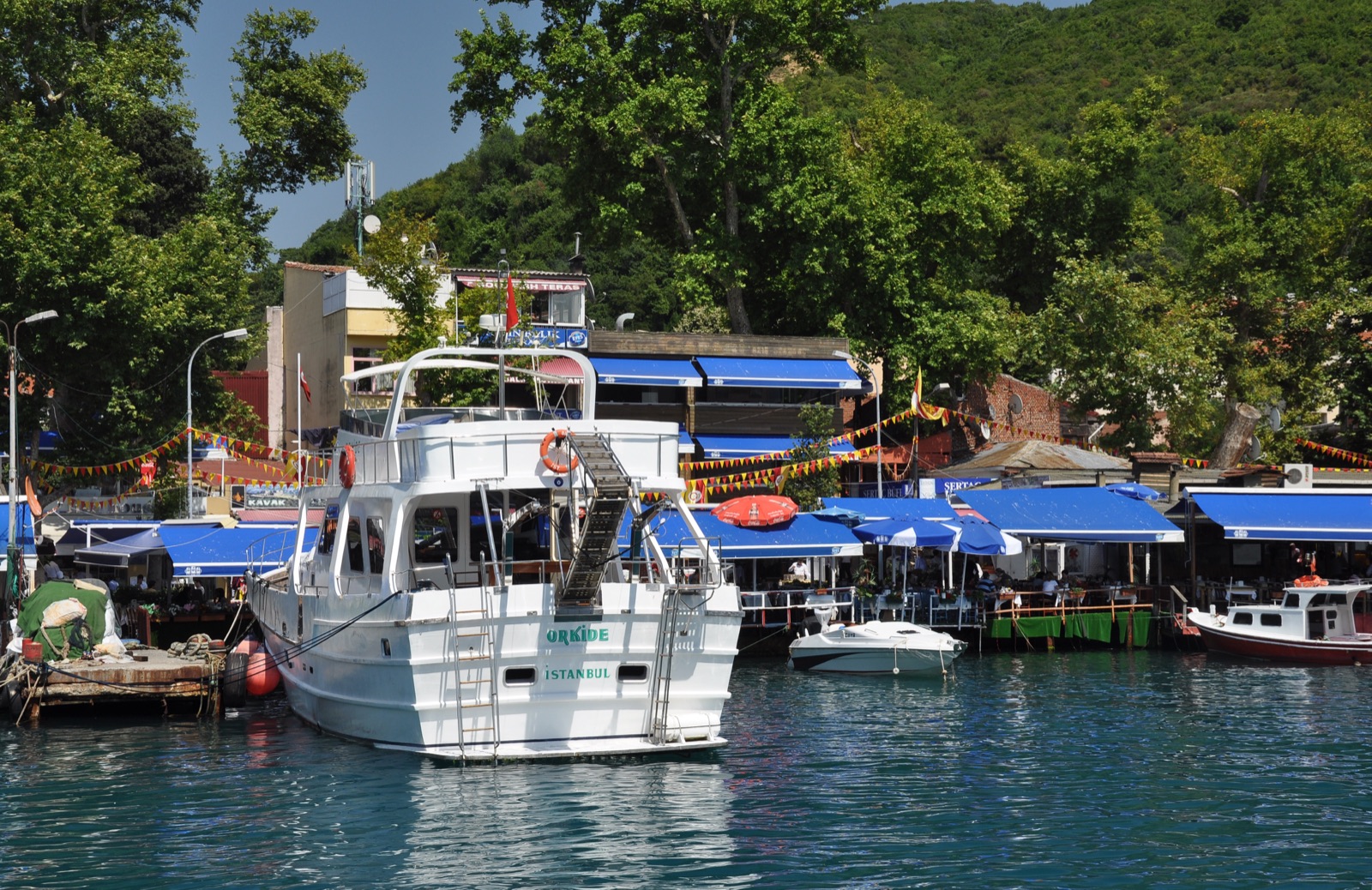
"Yoros Kalesi was built by the Genoese." Too simple, and essentially wrong. The fortress has Byzantine origins; the Genoese controlled and used it later.
"Beyond Anadolu Kavağı, the sea is completely closed off." No. The Bosphorus opens into the Black Sea and is a central international shipping route, even though there are militarily sensitive areas.
Anadolu Kavağı as a strategic location
Anadolu Kavağı lies far in the north of the Bosphorus, near the zone where the strait opens into the Black Sea. That's exactly why the place was militarily and economically important. Anyone wanting to control the Bosphorus had to monitor not just the middle of the strait, but also its entrances.
The small town developed as a harbor and fishing settlement. Ships could wait here, be supplied, or hope for favorable conditions to continue their journey.
The Yoros fortress rises above the town.
Yoros Kalesi and the open question of its origins
The walls visible today are mostly dated to the Byzantine era, though the site was likely used strategically even earlier.
The fortress controlled a high point with a wide view over the Bosphorus and the Black Sea.
As with many of Istanbul's fortifications, individual building phases are hard to separate precisely from one another. Walls were repaired, expanded, and continued in use under new rulers.
Genoese, Byzantines, and Ottomans
Yoros is often loosely called a "Genoese castle." That's too simple. The complex had a Byzantine history and was, for a time, controlled or used by the Genoese.
The Ottomans later took over the site. Its strategic function remained: monitoring shipping traffic and controlling the northern Bosphorus.
Genoese connections are real, but reducing the castle exclusively to this phase makes its history smaller than it is.
Inscriptions and religious signs
Byzantine inscriptions and signs, including Christian symbols, appear on the walls. Such details help in understanding building phases and use.
Precisely because the fortress looks partly ruined today, it's easy to overlook that it once had organized gates, garrison quarters, and defensive structures.
Ruins look romantic. Militarily, they were once very functional.
The Bosphorus before modern navigation systems
The journey toward the Black Sea was dangerous. Currents, fog, wind, and narrow passages could put ships in difficulty.
Watchtowers, fortresses, and local pilots were therefore important parts of navigation and control.
Yoros was part of this maritime safety landscape.
Anadolu Kavağı today
Today, many visitors associate the town with fish restaurants and excursion ferries. Anyone arriving on a long Bosphorus cruise often has only limited time to stay.
The climb up to the fortress takes some energy, especially in summer. The view, though, rewards you with a panorama that feels considerably more open than in the inner Bosphorus.
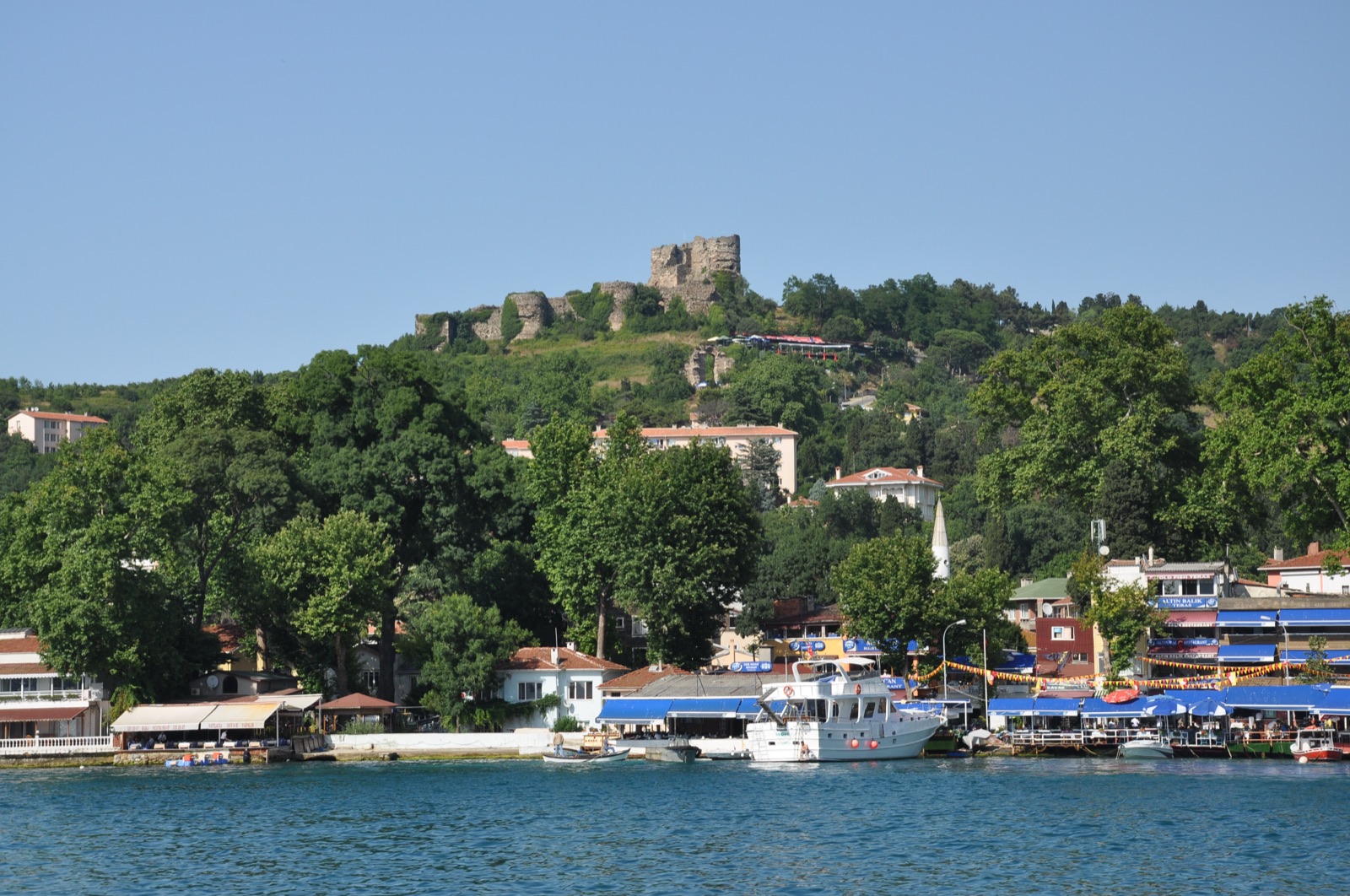
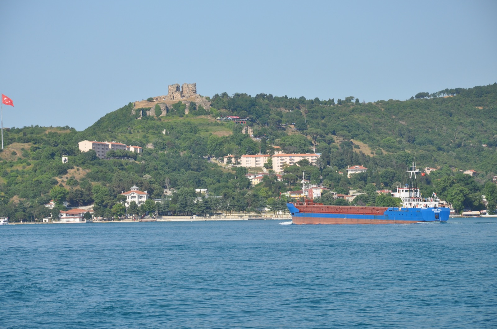
You see how the city gradually gives way to landscape.
What's original today
The ruin has been altered over the centuries. Parts of the walls are Byzantine, others were repaired or continued in Ottoman use.
Archaeological work has made additional structures visible.
So you shouldn't expect Yoros to be a perfectly preserved knight's castle. Its value lies precisely in its layers.
Why the excursion is more than "eating fish"
Anadolu Kavağı shows Istanbul at a geographic edge point. After days in Sultanahmet or Beyoğlu, the place feels almost like a different city.
And yet it's exactly this location at the entrance to the Black Sea that has, for centuries, helped decide why the Bosphorus is so strategically important.
Yoros and control over the Black Sea
The fortress wasn't placed by chance where the Bosphorus opens up more toward the north. For Byzantium, access to the Black Sea was enormously important economically. Grain, fish, wood, and other goods came from regions around the sea.
Whoever controlled this route had influence over supply and trade.
Yoros was therefore part of a larger system of fortifications, signal points, and coastal settlements.
Ottoman use after 1453
After the conquest of Constantinople, the Ottomans didn't simply take over a ruin that had become meaningless. Control of the Bosphorus remained militarily important.
The fortress was repaired and continued in use. Only with modern artillery, new forts, and changed defensive concepts did a medieval hilltop castle gradually lose its military function.
Why the view from above is historically helpful
From Yoros, you don't see the Bosphorus as a pretty blue line, but as a strategic corridor. The narrow points and the opening to the Black Sea become spatially understandable.
Suddenly you understand why fortresses were built on these slopes at all.
A good view can sometimes explain history better than ten maps.
My take on this place
What I like about excursions like this is that you notice just how vast Istanbul really is. You start in a metropolis of millions, travel a long way along the Bosphorus, and at some point everything feels calmer, greener, and almost like a different place.
And then a ruined fortress stands up above, reminding you that this beautiful strait was also controlled, defended, and fought over for centuries. It's exactly this shift between "look how beautiful" and "wait, what all happened here?" that is Istanbul, to me.
– Amra