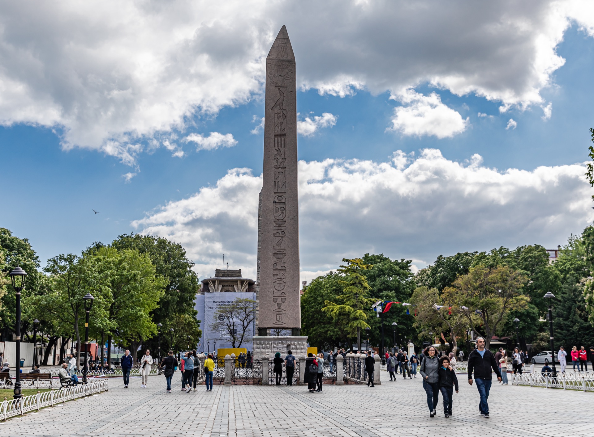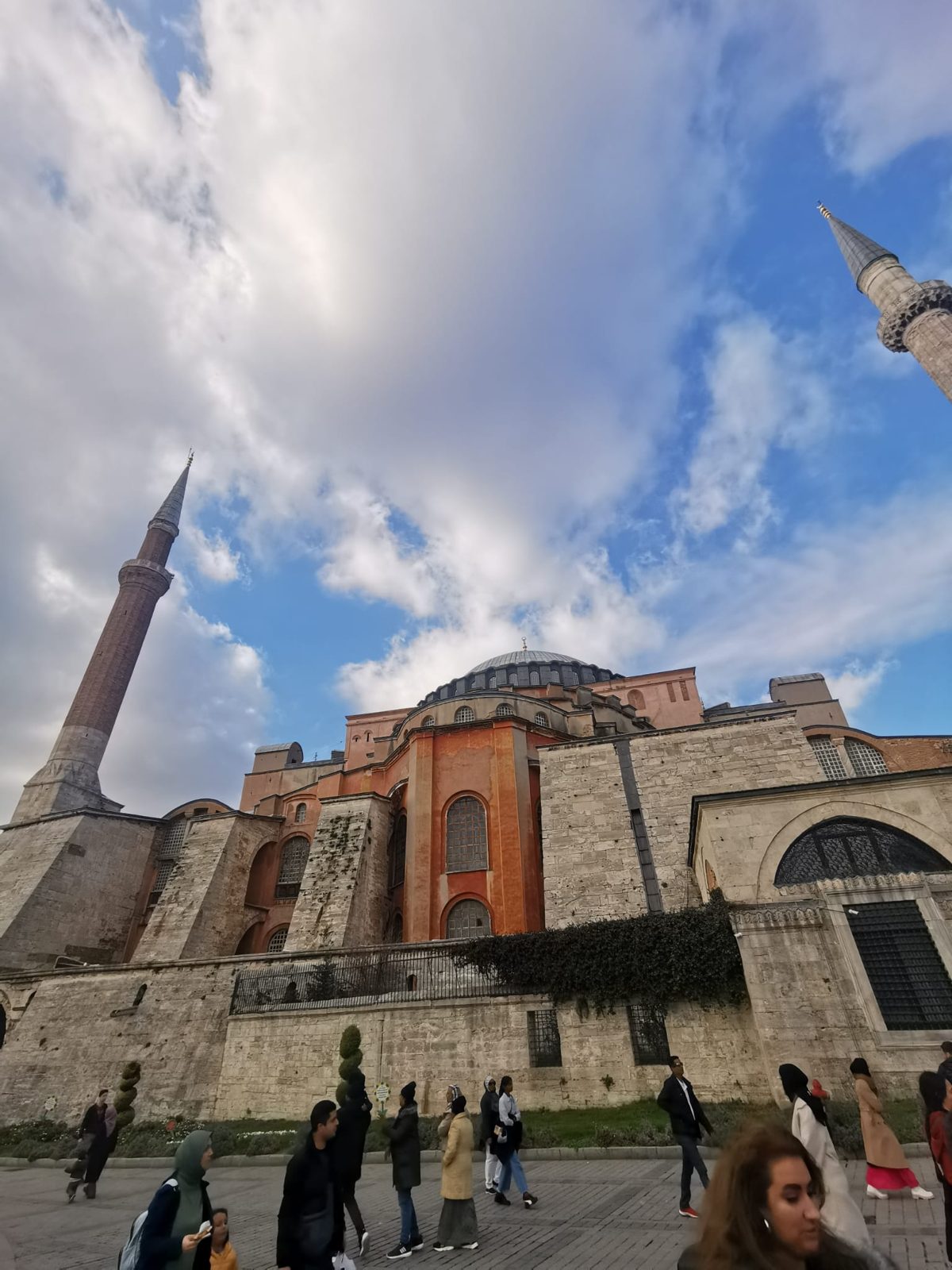

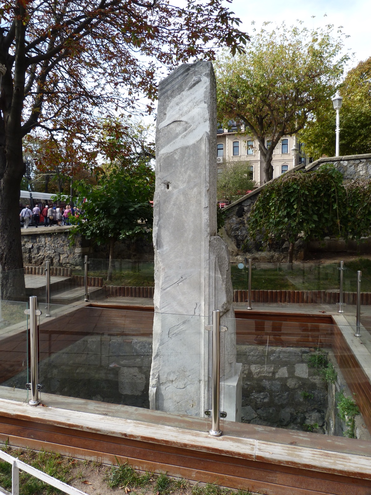
Between the Hagia Sophia and the start of Constantinople's old main street stands a fairly unassuming remnant today. If you don't know what you're looking for, you'll probably walk right past it. Yet the Milion was one of the most symbolically important points in the late antique capital. It marked the point of origin from which distances along the empire's great roads were calculated, or at least represented — comparable to the Milliarium Aureum in Rome.
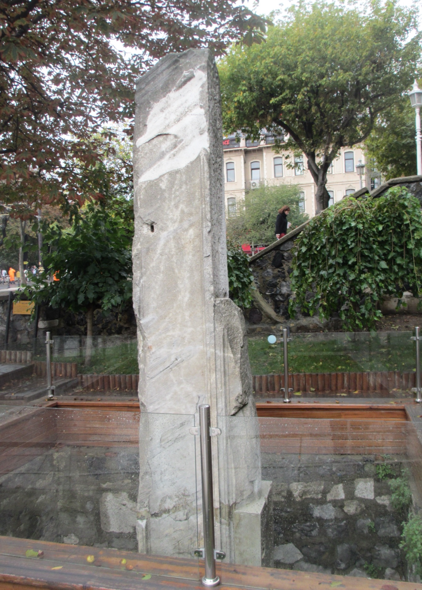
Between the Hagia Sophia and the start of Constantinople's old main street stands a fairly unassuming remnant today. If you don't know what you're looking for, you'll probably walk right past it.
The original monument was of course far larger than today's remnant. It was a tetrapylon-like arched structure at one of the most central points of Constantinople, near the Augustaion, the Hagia Sophia, the Hippodrome and the imperial palace. Anyone heading from there onto the great Mese, the city's main street, was moving symbolically from the center of the new Roman capital out into the empire.
- The Milion was built in the 4th century in connection with Constantine's new capital.
- It stood near the Hagia Sophia, the Hippodrome and the Great Palace.
- It marked a symbolic point of origin for distances along the empire's roads.
- Its model was the Milliarium Aureum in Rome.
- The monument was originally a much larger arch or tetrapylon structure, not just today's stone remnant.
- The Mese, Constantinople's most important ceremonial and commercial main street, began here.
- The structure was damaged in the Middle Ages and largely disappeared over the course of the Ottoman era.
- Today only a small, partly reconstructed or excavated remnant recalls its former significance.
What was the Milion?
The Milion was no ordinary milestone by the roadside. It symbolically marked the point of origin from which distances on the empire's great roads could be thought of, or stated, in relation to Constantinople. The idea drew on the Milliarium Aureum in Rome. When Constantine built up his new capital on the Bosphorus, he didn't just adopt building forms, titles and ceremonies from Rome — he also created spatial symbols that staged Constantinople as the new center of the empire.
The original structure was likely far more monumental than the small surviving remnant suggests. Reconstructions describe a tetrapylon-like structure defined by four piers or arches, standing at a crucial road junction near the Augusteion, the Hagia Sophia and the imperial palace. From here began the great main street, the Mese, which ran through Constantinople to the west and connected further with the empire's long-distance roads. The Milion thus stood at a point where urban planning and imperial geography converged.
For a person of late antiquity, distance was of course not measurable in as standardized a way as with GPS today. Road markers, milestones and travel routes worked differently depending on the region. So one shouldn't claim that every kilometer of the Byzantine Empire was mathematically calculated precisely from this one stone. Symbolically, though, the Milion was enormously important: Constantinople presented itself as the center from which roads led out into the provinces.
That today only a small remnant stands next to the traffic of Sultanahmet is almost ironic. People walk from the Hagia Sophia to the Cistern, look at their phones, search for a restaurant, and pass by a monument that once embodied precisely the idea that this was the starting point of the world's roads. That's exactly why it's worth pausing for a moment — not because the surviving stone looks spectacular, but because it explains how the capital understood itself.
The Milion was a mile monument. Its name is connected to the Latin mille, thousand, and to the Roman mile.
In Rome, the Milliarium Aureum stood near the Forum. Constantine transferred this imperial concept to his new capital, thereby declaring Constantinople not just practically but symbolically a new center of Roman rule.
So the monument was no ordinary waymarker. It was a statement about where the empire saw its own center.
Why Constantine needed a new center
When Constantine built up Byzantium in the early 4th century, he wasn't enlarging some provincial town. He was creating a new imperial capital.
For that he needed a palace, a forum, a hippodrome, churches, a senate and public monuments. Just as important were ceremonial streets and symbolic points of orientation.
The Milion fit perfectly into this program. Rome remained historically significant, but Constantinople was meant to speak the same imperial language.
The Mese: Constantinople's great main street
From the area of the Milion, the Mese ran through the monumental center of Constantinople and further west. It wasn't a single straight street all the way to the city walls, but a system of important main axes that branched out and connected the great forums with one another. Imperial processions, merchants, soldiers and ordinary residents used these routes.
Along the Mese lay squares and monuments through which the empire presented itself. Anyone moving away from the Milion was thus moving through a kind of political landscape. This helps explain why the small remnant seems so unassuming today: its meaning lay not only in the structure itself, but in its position at the start of an entire network of streets and squares.
From the area of the Milion, the Mese, the "middle street," ran westward through Constantinople. It passed through important forums and later split into various main axes toward the city gates.
Processions, imperial entries and public ceremonies took place on this street. At the same time it was a commercial axis lined with porticoes and shops.
Anyone walking today through the modern streets of the historic peninsula can't trace the exact ancient route everywhere one-to-one, but the old traffic logic still shapes parts of the city today.
How distances were measured in the Roman Empire
Roman roads were structured by milestones. Distances could be given between important points and cities.
The Milion symbolized Constantinople's point of origin in this system. The often-repeated modern phrase "all roads were measured exactly from this stone" is, however, too simple. The empire had regional road systems and older reference points of its own.
Its significance was above all representational: Constantinople presented itself as the center from which the empire's world could be thought of as ordered.
What the original monument looked like
Reconstructions describe the Milion as a tetrapylon-like structure with four piers and arches. It spanned, or marked, an important stretch of road.
Later Byzantine sources mention statues and decorative elements. Depictions of various rulers and religious images may have been added over time.
As with many vanished monuments, our picture shifts depending on the source and the archaeological evidence. So one shouldn't mistake a modern 3D reconstruction for photographic certainty.
What happened to it in Byzantine times
The Milion remained a well-known point of orientation for centuries. Because it lay close to the political and religious center, it also became the scene of public events and conflicts.
Fires, uprisings and earthquakes repeatedly damaged the surrounding area. Individual parts were repaired or altered.
As the Byzantine Empire shrank, its symbolic significance also changed. The claim to be the center of a vast Roman road network eventually no longer matched political reality — yet the name and the site remained.
Why so little remains today
After the Ottoman conquest, the Milion lost its former administrative and ceremonial function. Parts of the old city center were rebuilt, ancient stones were used as building material, and street levels changed.
In the 20th century, remnants were identified or uncovered during construction work. The section visible today, however, barely conveys the scale of the original monument.
This is one of those cases where a small ruin seems almost meaningless without explanation. Only the historical context makes it significant.
The Milion as Rome's successor — and what Constantine meant by it
Constantine's capital project was full of deliberate references to Rome. He founded a senate, built forums, erected ancient statues and created an urban topography meant to be read in imperial terms. The Milion belonged to this symbolic language.
A new imperial center needed not just administrative buildings, but also signs that told people: from here, the world is ordered. A mile monument was ideal for this. It linked the abstract idea of rule with something very practical — roads and distances.
At the same time, Constantinople always remained part of the Roman Empire. The Byzantines called themselves Romans. The modern distinction of "Rome here, Byzantium there" would have meant little to many residents of medieval Constantinople. The Milion is therefore a small place where this Roman continuity becomes especially visible.
Proximity to the Hagia Sophia, the Augusteion and the Great Palace
The location was extremely prominent. In its immediate surroundings lay the Augusteion, the Hagia Sophia, the entrance to imperial palace areas, the great baths and the Hippodrome. Anyone standing here stood at the political heart of the capital.
This proximity explains why the Milion was more than a traffic point. Processions, imperial appearances and religious events passed through the same space. Orientation, ceremony and power practically overlapped here.
Today this relationship is harder to recognize, because modern streets and later Ottoman buildings overlay the ancient topography. That's exactly why you need either a reconstruction map — or a bit of imagination.
Why small archaeological remnants are easily underestimated
With large monuments, the architecture does part of the explaining by itself. No one stands in front of the Hagia Sophia and asks whether the building might have been important. With the Milion, it's the opposite. A small remnant of wall has to have its significance restored to it through knowledge.
That's typical for archaeology in a continuously inhabited city. Many of the most important sites are not fully preserved. Streets, houses and later monuments stand on top of them. What remains can look unassuming and still have had an enormous historical function.
Places like this are exactly the challenge for a good travel guide. You shouldn't pretend you're looking at a huge monument today when you're not. But you should be able to explain why this small remnant once stood at the center of a world city.
What today's visitor actually sees
The visible remnant stands near the tram line and is easy to overlook today amid modern street furniture, traffic and the surrounding sights. You don't see four monumental arches or a splendid late-antique plaza. A good article should say that plainly.
It helps to mentally turn around from the remnant: nearby lay the Hagia Sophia and the Augusteion, and right next to it began the great road axis heading west. Then it becomes clear why the spot mattered. The Milion didn't function as an isolated monument, but as part of a dense imperial center.
Anyone with a reconstruction in hand understands the scale immediately. Without one, it takes a bit of imagination — but that's exactly what makes the place interesting to me.
From zero point to city memory
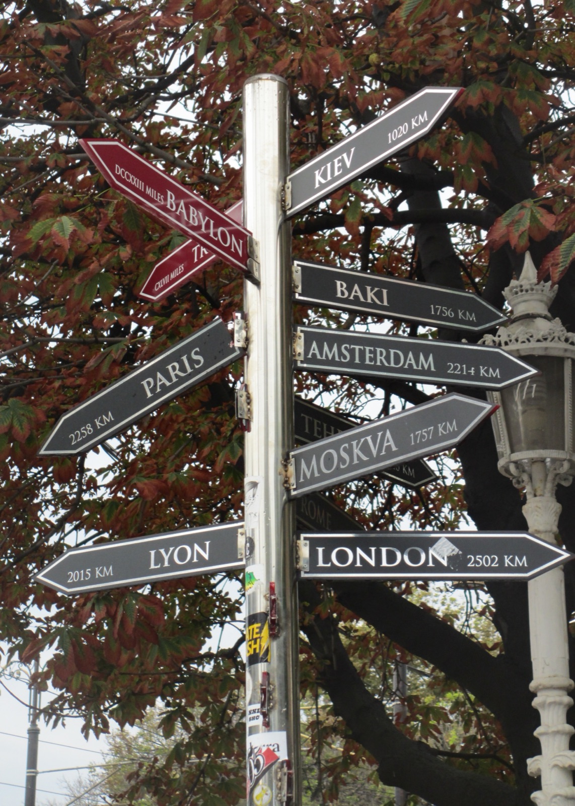
A reference point for distances sounds technical at first. In fact it holds a political idea: whoever sets the zero point symbolically determines where the center lies. Rome had its Golden Milestone; Constantinople received its own counterpart in the Milion.
Centuries later this function lost its practical meaning, but the idea remains strikingly modern. Even today's states define kilometer-zero points from which road distances are calculated.
The Milion thus connects Roman administrative history with something we still know today — except the modern zero point is usually just a sign, whereas Constantine turned his straight into an imperial monument.
"The Milion was simply a single milestone." Too simple. The original monument was a larger architectural arch structure.
"All roads of the Byzantine Empire physically began exactly here." No. The Milion was a symbolic and administrative reference point, not the literal starting point of every road.
"The stone visible today is the complete original monument." False. It is only a small remnant, part of the archaeologically reconstructed memory of a much larger complex.
My take on this place
This is exactly the kind of place I wanted these articles for in the first place. You walk through Sultanahmet, the Hagia Sophia in front of you, thousands of people behind you, and then there's this rather unassuming remnant. Without any information, you might genuinely just think: huh. A stone.
But then you read that this spot was once symbolically the center from which Constantinople thought about distances into the empire, and suddenly a stone turns into an entire idea of a city.
That's also the reason behind my IstanbulEssence app. Whenever you stand in front of a column, a stone or a small remnant of a wall, you shouldn't just say, "Oh, that's tall." You should be able to look it up and think: ahhh — that's why this is here. That's exactly when Istanbul becomes the most fun for me.
– Amra